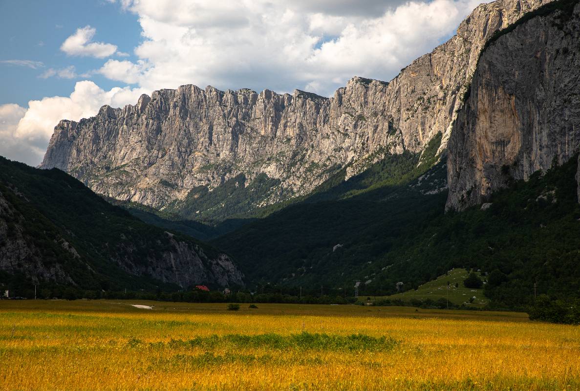
It then follows the local road toward the village of Duži, along the edge of the Komarnica River canyon, descending into the Komarnica Canyon below the village of Duži. The line crosses to the left bank of the Komarnica River, follows the canyon edge of the Komarnica River and then the Nevidio Canyon to the place called Cikavac. It then follows the boundary of state-owned land below Poljica, Osoje, and Komarske grede, all the way to the upper part of the village of Kozarice.
The boundary changes direction across state-owned land toward the south and southwest above Krivača to the Skakavac Waterfall. It ascends along the Grabovica River for about one hundred meters, bypassing private property, up to the elevation of 1,210 meters, continuing along the ridge tops past Donja Čeoca to Široka greda and the place called Graca, toward the area known as Dolovi. From there, the line turns southeast along the boundary of the Bolj forest complex to the place Gornji Čeoci. The boundary then continues across state-owned land northward below Nesilino Brdo to the Grabovica River, and then along the Morava River northward, bypassing private property above Velika Poljana at the elevation of 1,594 meters, continuing north to the starting point at Ranisava, elevation 1,750 meters.
The “Dragišnica and Komarnica” Nature Park is classified as a Category III protected natural asset, with the following primary conservation objectives:
- 1. to preserve and protect the survival of specific and exceptional natural values and unique natural phenomena of representative quality and spiritual significance;
- 2. to provide opportunities for research and education related to nature, as well as its presentation to the public, in accordance with management objectives;
- 3. to eliminate and prevent excessive exploitation of natural resources and activities that are not in line with conservation goals;
- 4. to ensure benefits and advantages for the local population from natural resources through responsible and efficient management, in accordance with conservation objectives.
These conservation objectives are achieved through the implementation of planned activities and measures, as well as through differentiated spatial management of the nature park (various management regimes).
The fundamental target values of the “Dragišnica and Komarnica” Nature Park are the preservation and protection of specific and exceptional natural values and unique natural phenomena of representative quality and spiritual importance; the provision of opportunities for research, education, and public presentation of nature, depending on management goals; the elimination and prevention of excessive exploitation of natural resources and activities incompatible with conservation objectives; and the обеспечение of benefits to the local population through responsible and efficient management, in line with conservation goals. These objectives are realized through planned activities, protective measures, and diverse management regimes within the park area.